Over 500 miles of trails

Someone said that there are over 500 miles of trails in Marin County. I'm going to hike all of them. Want to hear more? Read on...

Name:
Location: Woodacre, California, United States

Well, I hike, obviously. I read, without retaining, lots of stuff but mostly classic and contemporary fiction, history, and science. I look at birds and plants. I play my guitar far less than I ought, and watch movies far more. I like to ask people questions, but only if they ask me questions in return. I aspire to honorable behavior and am mostly successful. I'm on the cusp of a career change, with bird research in my past/present and academic librarianship in my future. Occasionally I bust out and cook six course gourmet meals for my friends; for some reason it's always six and never seven or five. Enough about me. What about you? Stranger or friend, drop me a line!

Tuesday, June 20, 2006

Can I boast about something? I have to admit, I feel pretty proud of myself- hopefully I'm not struck down by some higher power for my hubris. It might not sound like much, compared to the accomplishments of marathoners and iron-person competitors. But for someone to whom feats of physical endurance have never come naturally, I feel that hiking 19.6 miles in 9.5 hours is pretty good.

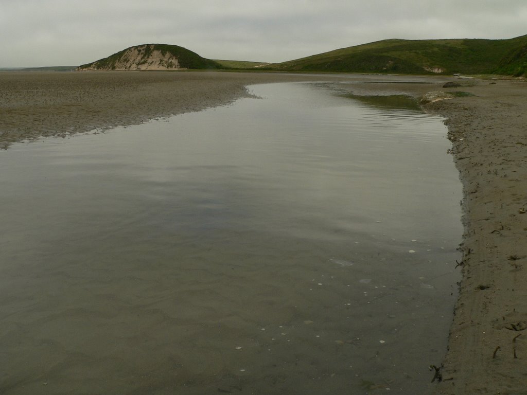
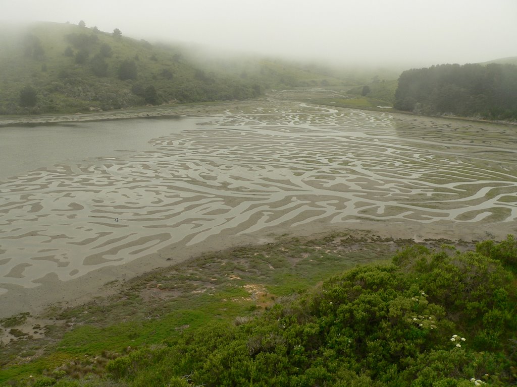
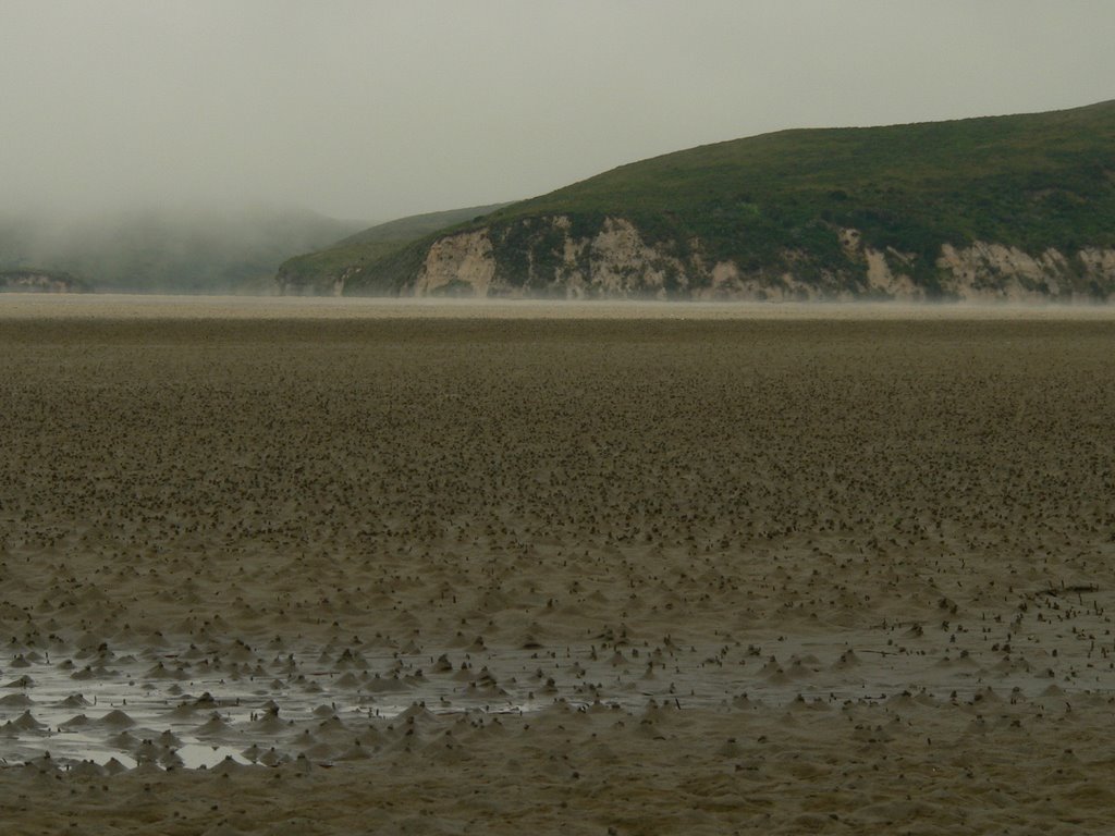
I went on Sunday, to the Point Reyes National Seashore, and when I started I was thinking the route I had picked out was maybe, 16 or 17 miles, which is still further than I've hiked before. I quickly figured out that it would be longer than I had planned, but I had plenty of food, and, well, almost plenty of water, and I figured I'd just go ahead as planned anyway.

I started on the Five Brooks trailhead on Rte 1 and hiked the Stewart Trail up and over the ridge to the Wildcat Camp on the coast. That was the first 6.7 miles. I then proceeded south along the Ocean Lake Loop Trail (which features a great view point of the coast) to the Coast Trail, past Alamere Falls (at which point I took a .8 mile side trip to see the actual falls. There were naked guys there.) and Bass Lake to the junction with the Lake Ranch Trail, which was the previous northernmost point to which I had hiked the Coast Trail. Hiked back along the Coast Trail, then joined up with the Old Out Trail at 13.2 miles (including the side trip), took that back up to the Alamea Trail, which joined up with the Ridge Trail, merging with the Bolema Trail to the Olema Valley Trail and then back to the trailhead.

And then the aftermath. I was feeling very peppy for the first 13-14 miles or so, but the last six miles took their toll. When I got home at 7pm I called up my dad for Father's Day, showered, and then hopped straight into bed. I woke up with some strange aches and pains. I was sensible enough to stretch out all the obvious muscle groups during and after the hike, so my legs were ok. My butt was sore, which wasn't entirely surprising. But my ribs? My neck? And, of course, it turns out that a single application of sunblock is not near enough to get you through 9.5 sweaty hours. I guess I could have told you that beforehand if I'd thunk it through, but I'm a bit lobstery now.

I think the best thing I figured out was that taking a break, stretching, and then lying down with your feet elevated makes a big difference in staving off tiredness. Of course I'd read this before but never really tried it out. It was kind of nice.

Monday, June 19, 2006

On Saturday (June 17)Arty and I hiked the Dixon Ridge Trail, just a couple of miles in, across the private land, to the public land, then back to the private land again.

It's a pleasant hike, passing in and out of shady areas and sunny areas, views and glades. There are a lot of birds. I saw juvenile chestnut backed chickadees and Swainson's thrushes. In fact, it's a unique place, kind of like all the other unique places I've been to so far on this project.

It's all the more unique because of a one-quarter mile section of the trail that's at the center of a conflict pitting the owners of the land it traverses against a group of citizen-recreationalists from San Geronimo Valley and beyond. The trail segment in question is currently accessible to the public. However, the landowners hope to preserve their right to restrict public access for the sake of building their dreamt-of Pinot Noir vineyard, which would be negatively impacted by heavy public use. A local group of citizens is trying to convince/cajole/coerce them into granting an easement to guarantee continued access to the trail segment. If that fails, apparently it goes to the courts. According to this citizen group's website, a proposal to reroute the trail is unacceptable, as the proposed reroute would traverse an area prone to landslides and would cost the county too much money to maintain (yes, stealing the land would be cheaper- they do have a point there). For more info, check out this story in The Point Reyes Light.

I'm kind of getting the sense that I'm taking the unpopular side by saying this, but my sympathies still reside with the landowners, as I've stated in a previous post. This is what I came up with while I was hiking the trail:

1) How many other counties in the United States with comparable population densities can boast the sheer acreage of publicly owned land that Marin County, California does? Marin County Open Space District owns 33 separate parcels all available for your outdoor recreating pleasure. Then, there's the Point Reyes National Seashore, Samuel P. Taylor State Park, the Marin Municipal Water District, Mt. Tamalpais State Park, the Golden Gate National Recreational Area, Mount Tamalpais State Park, Muir Woods National Monument... am I forgetting anything? With this embarrassment of riches, it seems almost gauche to try to seize private land for the purpose of... *MORE* outdoor recreation!

2) I'd prefer to hike where I'm welcome, just as I'd prefer to enter someone's home with an invitation to dinner rather than a search warrant, and just as I'd prefer to hire a taxi wherever I'm going rather than hijack someone's car. I'm glad that the neighbors of these folks are willing to grant me access to their land, and I'll gladly take them up on it if they'll have me. But if the landowners in question want to build a winery rather than have a hiking trail on their land, then I don't particularly want to force my way into their party. It'd just feel awkward, don't you think?

3) The house I grew up in used to be beige. I've driven by it recently, and it's now lavender, with purple shutters. I kind of liked it better when it was beige, but I don't feel entitled to have the house taken away from its current owner because his color choice is not to my liking. If I really wanted it to remain beige, then I shouldn't have sold it in the first place. If this trail is something that needs to persist in its original state, why didn't Marin County Open Space District buy it to insure its continuance at the time it was for sale, knowing that the purchaser would have no legal obligation to do so? In the above referenced article, County Supervisor Kinsey is quoted as saying, "In the same way that farmers get upset when the public tries to put a trail across their ranches, the public gets upset when farmers try to put a ranch on their trail.” Well, this seems kind of obvious to me, but maybe it needs pointing out: if the public doesn't want a ranch on their trail, then they need to make sure their trail doesn't get bought by a rancher.

Sunday, June 11, 2006

Relief from the bare austerity of prose. Here are some pictures of the Estero Trail hike described in the 6/4/2006 post, courtesy of my talented friend Kerry.


I'm taking a little hiking break this weekend. Was starting to feel burnt out, and as if I was obliged to hike.

I did hike on Tuesday. Solo (Arty's not allowed in Samuel P. Taylor), to the top of Mt. Barnabe at Samuel P. Taylor State Park. A 'solo ascent of Mt. Barnabe' sounds all impressive, but really it's only 1466' in elev., and it was named after a pet mule, to boot. So really it's no big deal. I took the easy way up, the hard way down. Starting from the pullout across Sir Francis Drake Blvd. from Devil's Gulch, I walked up said gulch to the bridge next to the giant redwood, which was evidently spared whenever the area was logged. The trail intersects here with both the Bill trail and the Barnabe Fire Road. The Bill trail was built to bring one most of the way up Mt. Barnabe at no greater than a 5% grade. So it was a longish (~3 miles) but very mellow climb through bay forest. Along the way you can (and I did) take in Stairstep Falls in a short side-trip. At this time of year it's a little puny, and it just so happens that a tree recently has fallen down the waterfall and become lodged there, blocking to view to a large degree. If you visualize hard enough you can see that it would be an impressive sight, at the right time of year, with no tree.

The way up was pleasantly windy (with a long 'i') and twisty and switchbacky, with the five percent grade making you work *just* enough. Nearing the top, you are unceremoniously dumped upon the Barnabe Fire Road, which has no limits set upon steepness. For the last .5 mi or so to the top of Mt. Barnabe it's a bit of a slog. But the views are worth it. On a rare, perfectly clear day, I would imagine you could simultaneously see the Ocean on one side and the Bay on the other. As it was, I could see Tomales Bay on one side and San Rafael on the other. And to the south, I could see Kent Lake and a great view of the spillway of Peters Dam. It was very windy (with a short 'i') and I hunkered in the shelter of a rock outcrop, enjoying some lunch on an impromptu board-bench that someone had rigged up. I thought about my friend Jen's cat, named Barnaby (different spelling but I always called him Barn-Barn, anyway), who died maybe about a year ago, or so. I've been feeling very tender toward the idea of pets dying. I think, with Victor gone, I lean on Arty a lot more and the thought of him dying seems especially poignant right now. I also saw 'The Wild Parrots of Telegraph Hill' on Friday night, which just made me think all the more about animals dying, and about animals in general as individuals with their own wills. I wish pet lifespans more closely approximated human lifespans. I saw a story, recently, about a tortoise that's 175 years old, the oldest known living animal. The tortoise may have belonged to Darwin, but this bit of legend is perhaps apocryphal (though you have to read a little ways before that's admitted in the story).

Anyway, enough of that tangent. After I finished my reflections upon Barn-Barn, I descended via the Barnabe Fire Road, from which I continued to enjoy good views much of the way down, but which was knee-poundingly steep. Maybe in the future I'll start taking the steep way up, to better preserve my knees. My friend Lisa, who coincidentally had done a hike up Mt. Barnabe just two days previous, reports that the other path to the top, the Ridge Fire Road, is similarly steep. I'll probably hike up that when it comes time to do it, and back down the gentle Bill trail.

Sunday, June 04, 2006

Which brings us to the hike I went on today. I had big plans last night... I was going to hike to the top of Mt. Tam (elev. 2517') from a starting point of 200' elevation, up this really steep trail. And, I was going to wake up at 5 in the morning to do it. Needless to say, this didn't happen. I woke up at 5 and it was all grey and the bed was warm... and then I woke up for real at 7, which would have been perfectly sufficient in terms of leaving enough time, but I also wanted to beat the crowds since I was going to bring Arty on that hike. So I chose another hike, less popular, closer to home, easier, and still Arty friendly.

Starting from the Shafter Bridge just east of Samuel P. Taylor State Park, I hiked up the Peters Dam Fire Road to the dam that stops up Kent Lake. Continuing on the south/east shore of Kent Lake, the fire road circles round and climbs the steep slope next to the lakeshore, then drops back down to the lake's edge after about 2.3 miles. Arty and I paused here to contemplate all the dead trees poking up out of Kent Lake, then continued onward and upward till our trail met the San Geronimo Ridge Trail. This trail is quite rollercoastery and therefore popular with mountain bikers, so I had Arty on leash most of the way. After hiking the trail for about a mile, there's a little side trail that goes off to a great vista point of the lake below. Someone had carried in a couple of boards from which they fashioned impromptu benches, and it was a comfortable place to sit and look across the valley to Pine Mountain Ridge and Bolinas Ridge beyond. Back on the ridge trail, I kept going east until I hit the intersection with Hunt Camp Fire Road. I had previously hiked the ridge trail as far west as this; with today's hike it looks like I've hiked the entire San Geronimo Ridge Trail.

Poor Arty was patiently on leash up until this point with nary a mountain biker in sight. I was just considering releasing him when the onslaught began. There seems to be a local mountain biking club that wears orange and purple jerseys, and it seems to have quite a large membership. I encountered around 20 of them today, interspersed with mountain bikers that were apparently unaffiliated. They were all courteous and friendly enough, except for one orange and purple guy who hurtled by doing around 35mph. Arty was on leash but in the middle of the trail, and the guy was going so fast that I barely had time to yank him out of the way. The biker had a clear line of sight to us at the bottom of the hill and could have braked but clearly just didn't want to. I indulged in violent retribution fantasies for a little while until I regained my composure.

Backtracked to the junction with Peters Dam Fire Road, then took the Ridge Trail down the last 1.2 miles back to the trailhead. I think it was around 7 - 7.5 miles, all told.

My daypack had deteriorated to an embarrassing state, but it is hopefully now restored to respectability. Today, before my hike, I carefully applied deodorant. However, approximately 3 miles in, I noticed that I smelled like a horse. Not just any horse, but maybe how Man o' War would have smelled after a particularly close race for the Belmont Stakes. This has happened on my last few hikes. The problem is that the straps on my pack had become inoculated with my armpit bacteria over the course of successive hikes, such that the bacteria are reactivated by my body heat/sweat each time I hike and party down in some sort of bacteria smell-o-thon.

After my hike today I applied a thick paste of baking soda + water to the regions of the backpack that are most intimate with my armpits. After carefully checking all compartments (I found a really old pack of gum!) I laundered the entire pack on gentle cycle and it is now drying on my front porch. We shall see.

I went on a hike on Friday with my friend Kerry. He took lots of pictures that I will insert into this post, once he gets over here to upload them to my computer. Meantime, here's the highlights: We hiked the Estero Trail to the Sunset Beach trail at the Point Reyes National Seashore; it's an out-n-back rather than a loop. This hike is choc-o-bloc full of interesting sights, though it's a very popular trail and I'm sure most of the folks around here have already hiked it. Early on you come to a grove of bishop pines of around 10 hectares, just sort of hanging out there amid all that coastal scrub. This grove seems to be a haven for all sorts of good birds: we saw/heard black-headed grosbeak, Swainson's thrush, Wilson's warbler, olive-sided flycatcher, and more. We also came across what looked a like a roosting site for band-tailed pigeon; tons of guano and pigeon feathers all over the place and that distinctive bird-poop smell. After exiting this grove we came to a footbridge crossing one finger of the estuary. On our return trip Kerry alertly located a black phoebe nest with at least three nestlings under this bridge. Trail climbs a bluff overlooking the estuary and as you look down from this bluff you see (if it's low tide, which it was for us) an amazing dendritic pattern described by the water channels in the estuary. Climbing up and over a couple more bluffs, you can see the structures used to farm oysters out in the estuary: they seem to just be wooden racks that have ropes attached to them that dangle in the water, to which the oysters attach. There's an article about impacts (or lack thereof) of oyster farming in the estuary in a recent issue of the Point Reyes Light, if you want to learn more. After the oysters you get to the intersection with the Sunset Beach trail, after which you cross this pain-in-the-ass part that's all marshy, with uneven terrain because of all the cows postholing through the mud (yes, there's a ton of cows on this trail- ranches on Point Reyes National Seashore continue to operate, presumably because they were grandfathered in when the park was created.) Despite the postholes we went *fast* through this part because of all the damn mosquitoes. The official trail probably ended somewhere in here but we continued onward to the mouth of the estuary. The beach was littered with little turban-shaped molluscs with spiral shells. These shells had a red lower tier, blue-purple middle tier, and silver top tier. They were quite remarkable; I should have had Kerry take a picture. There were also lots of starfish and sea-anenomes waiting for the tide to come back in. We sat out at the mouth of the estuary and ate some lunch, and watched the harbor seals lounging on a sandbar offshore. Two of them got into a tussle over a particularly choice bed of kelp right in front of us. On our way back we encountered a baby harbor seal separated from its mother that was on the beach, but slipped back into the water as we walked by. Hope it makes it. Also on our way back, we met a girl, Lindsay, who shared our hike back with us. She works at that organic farm in Bolinas that Prince Charles visited, and she grew up in New York City. And, she has Fridays off so maybe she'll come hiking with us again someday.